DEVELOPMENT DETAILS
Tonyrefail
225 homes
1, 2, 3 & 4 beds


LOCAL AMENITIES
Kitchen gardens
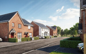
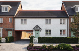
Parc Eirin sits within beautiful surroundings where residents will walk out of their front doors and straight into the breath-taking hills and mountains of South Wales. Although located in the region’s historic industrial heartland, the site enjoys a surprising level of seclusion and tranquillity. Once developed, it will deliver high-quality homes and a vibrant community, accessible to a large proportion of the population.
This 15-acre site is situated about 2.5km south of Gilfach Goch and 3km west of Tonyrefail, at the head of the Ely Valley.
Parc Eirin is in close proximity to Tonyrefail, a village boasting a number of primary schools, a High School, library, churches, shops, pubs and a rugby club. The site is adjacent to the A4093, providing a link to the A4119 (Llantrisant, M4)and the A4061 (Bridgend). More shops and services can be found at Llantrisant (along with the Welsh Blood Service, and the Royal Mint).
The National Cycle Route (4) is adjacent to the site; “The Celtic Trail”, part of NCN 4 covers 377 miles of the most diverse scenery in Wales, taking you from the eastern ‘Gateway to Wales’ at the Severn Bridge, Chepstow, to Pembrokeshire Coast National Park in the West, Running across Wales at its widest point, the Celtic Trail takes in St David’s, Britain’s smallest city, the spectacular Pembrokeshire Coast National Park, dramatic castles in Haverfordwest, Pembroke and Kidwelly, the magnificent Llanelli Millennium Coastal Park and the wide sweep of Swansea Bay.